


HOMESTEAD - T 1 Voting District, Florence County, Wisconsin
About
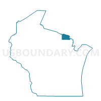
Outline

Summary
| Unique Area Identifier | 693696 |
| Name | HOMESTEAD - T 1 Voting District |
| County | Florence County |
| State | Wisconsin |
| Area (square miles) | 54.33 |
| Land Area (square miles) | 53.86 |
| Water Area (square miles) | 0.47 |
| % of Land Area | 99.14 |
| % of Water Area | 0.86 |
| Latitude of the Internal Point | 45.75263380 |
| Longtitude of the Internal Point | -88.27064910 |
Maps


Graphs
Select a template below for downloading or customizing gragh for HOMESTEAD - T 1 Voting District, Florence County, Wisconsin


Neighbors
Neighoring Voting District (by Name) Neighboring Voting District on the Map
- AURORA - T 2 Voting District, Florence County, WI
- AURORA - T 3 Voting District, Florence County, WI
- COMMONWEALTH - T 2 Voting District, Florence County, WI
- COMMONWEALTH - T 3 Voting District, Florence County, WI
- DUNBAR - T 1 Voting District, Marinette County, WI
- FENCE - T 1 Voting District, Florence County, WI
- FERN - T 1 Voting District, Florence County, WI
- GOODMAN - T 1 Voting District, Marinette County, WI
Top 10 Neighboring County Subdivision (by Population) Neighboring County Subdivision on the Map
- Dunbar town, Marinette County, WI (1,094)
- Aurora town, Florence County, WI (1,036)
- Goodman town, Marinette County, WI (619)
- Commonwealth town, Florence County, WI (399)
- Homestead town, Florence County, WI (336)
- Fence town, Florence County, WI (192)
- Fern town, Florence County, WI (159)
Top 10 Neighboring Unified School District (by Population) Neighboring Unified School District on the Map
- Florence School District, WI (4,423)
- Beecher-Dunbar-Pembine School District, WI (2,707)
- Goodman-Armstrong School District, WI (1,028)